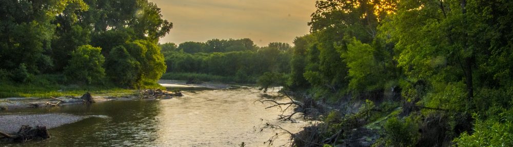
Glacial geologist Carrie Jennings stood at the overlook of the expansive and hilly Ordway Prairie to give us a brief lesson on our momentary view. “This is what Sibley State Park would look like without trees,” she said. Prairie, not forest; grass not oaks. Two different landscapes on the same glacial moraine, both now protected.
This came to mind this weekend in crow-flight miles to the west where another portion of this ancient glacial ridge was recently converted from prairie to croplands no one needs, followed by the construction of huge, towering grain bins and an access tower visible in all directions for all to see. Runoff from the marginal and vulnerable soils may threaten three lakes — Linka, Scandi and Gilchrist.
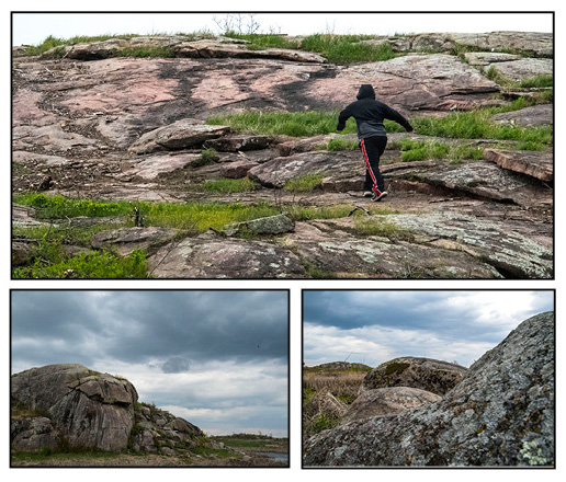
Then there was the hapless Ortonville, MN, councilman, who during discussions over a controversial gravel pit being protested years ago on a meadow blessed with outcrops just below the headwaters of the Minnesota River, said, “All we have are our rocks.”
Bear with me, for there is a connection. Yes, the Ordway and Sibley State Park are presumably safe from corporate and mankind encroachment for future generations to study and admire, yet the unique outcrops washed clean from the earth’s bedrock at the headwaters by the Glacial River Warren 12,000 years ago will likely never be turned into an “environmental memory pod” … otherwise known as a state park. Or, if you prefer, an “island of past landscapes.” Pods or islands where we may escape solastalgia — that feeling people have when home landscapes become unrecognizable through environmental change.
That was a term coined by Glenn Albrecht, honorary associate at the School of Geosciences of Murdoch University, which he says describes a “homesickness you have when you’re still at home.”
Many Minnesotans have historically escaped such feelings due to the foresight of those forefathers who invested in protecting these various islands of past landscapes, from prairies to woodlands, from bogs to trout stream valleys in the Driftless. Did they go far enough? Were particular pods of past landscapes missed or ignored? I’d suggest the outcrops as one possibility and the prairie potholes as another, both created by the last major glacier.
While I love the two pieces of Big Stone Lake State Park, divided between “Meadowbrook” and “Bonanza,” sadly those shouldered outcrops rising from the earth just below the headwaters will likely one day be little more than piles of rocky rubble from various future mining operations. Those rocks! A friend known locally as Babboo, who offers vivid descriptions on this area’s unique natural history, once gave an impromptu tour of the headwater outcrops and pointed out bison rubs so polished and smooth the granite glistened in the sun. This wasn’t unlike the gneiss and granite sample boulders polished by man-made tools at a natural history park outside of Rosendal, Norway. The difference was that one was the result of eons of rubbing by an iconic prairie animal now both rare and selectively domesticated versus that of a power tool.

Hence, there is no shrine here as at Itasca State Park for the headwaters of the Mississippi, although the outcrops are decidedly more bold and equally as interesting. How sad. Even sadder is that there is no island of past landscapes for the prairie potholes that are now 99 percent extinct due to drainage and ditching and commodity cropping. The closest you can find to true prairie is perhaps Blue Mounds and Glacial Lakes State Parks. It would be difficult, if not impossible, to preserve something that no longer exists. Solastalgia? Maybe, but then there is likely no one alive who remembers or can describe a prairie pothole vista. Can you miss something you’ve never had a chance to know? Or, see?
One needs to look no further than to the entrance of Blue Mounds State Park to realize it’s indeed an island surrounded by commodity cropping. Glacial Lakes has huge and magnificent native burr oak savannas, yet the beautiful prairie near the horse camp is part of the same moraine as Sibley and that prairie which was recently converted to commodity cropping. None of these portray the flat former prairie pothole region that existed past the ridge of the moraine — pockets of water that are partially visible after an early melt over frozen ground come spring. A flight overhead will reveal a half dozen or more potholes (wetlands or sloughs) per quarter section of cropped farmland as far as you can see.
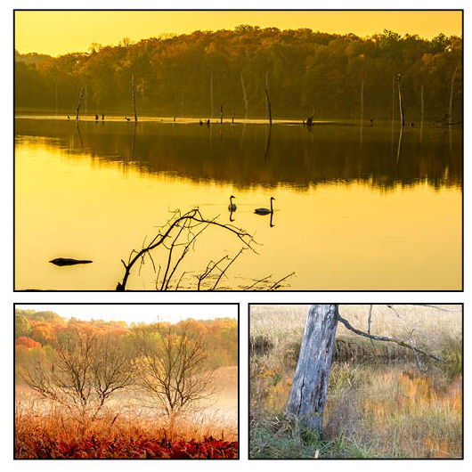
Many of the other landscapes have been set aside as islands of past landscapes throughout Minnesota. Sixty-seven state parks in all. Each offers a glimpse of a biome worth noting. For example, the bog at Bemidji Lake State Park offers us an opportunity to see extremely rare bog plants. The bog might have survived modern mankind, although the rest of the park’s landscape may have long been converted into lakeside cottages and a hilly, tree-lined suburbia … much like what is visible just outside of the park.
A recent drive through Camden and Maplewood State Parks offers other examples of landscapes preserved for future generations as well as reminders now of what was. Though both are “carved up” with roads and campgrounds, as are most state parks, Camden is surrounded by six-figure homes on the edge of the bluff overlooking the Redwood River. Yet that valley within the park is preserved and protected.
At Maplewood, which is surrounded by lakes crowded with cabins and small resort towns, it doesn’t take much of an imagination to see the same for those beautiful, deciduous wooded hills that are such a delight come autumn. Maplewood even has a motorless lake with a single, pack-in camping site that is ripe for largemouth bass and bluegill fishing. Again, a motorless lake!

Granted, nothing is perfect, and applause is awarded those who created and still create these beautiful shrines and protection for these past landscapes. These treasures should be as appreciated for what they are. Some have argued that Wildlife Management Areas (WMA’s) have served to preserve the prairie … though they are typically quite small, are basically restored rather than being native prairie and lack the potholes as well as the natural diversity common to virgin prairie. Besides, two of those WMAs near our farm are cut for hay each summer, downgrading their importance as wildlife havens.
Albrecht talks about the importance of a positive “sense of place” in people’s lives, and of the significance of what the geographer Yi-Fu Tuan called ‘topophilia’, or “the love of place and landscape.” In these two instances his topophilia went missing.

Some will argue that Big Stone National Wildlife Refuge has saved the outcrops within its boundaries, which is true, and much of the junk vegetation has been cut and removed from the rocks to make the granite and gneiss mounds appear more natural. It’s still a shame those outcrops closest to the headwaters aren’t protected, although while still possible is highly unlikely. Setting aside the prairie pothole biome as a possible “island of past landscapes” would be impossible for its natural state is long extinct. This unique landscape and ecosystem unfortunately never reached a point of the “homesickness you have when you are still at home” – a landscape missed and thoroughly ignored.
